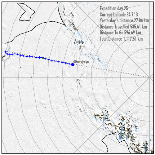
84.7ºS, 27.86km covered
Overcast day down in Antarctica but good visibility, so an other good day of progress.
Lucy’s counting down the days until their scheduled rest day at the half-way supply cache at the Thiels Corner skiway strip, looks like they will be there on Christmas eve.
A bit of info about the mapping I’m posting in these images. Up until now I’ve posted a map that (in the end) is generated from the NASA Blue Marble, (https://visibleearth.nasa.gov/collection/1484/blue-marble) which is a composite-visible light satellite image covering the entire world. The version I have I think is from 2008.
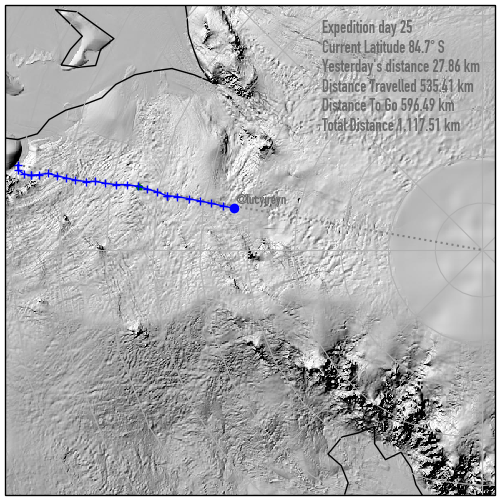
I’m also posting today a version which shows the elevation and terrain that the team have crossed, this is generated from the Reference Elevation Model of Antarctica (https://www.pgc.umn.edu/data/rema/) – one of the challenges of antarctica is that it simply isn’t mapped as well as the populated areas of the planet, and being at the poles, a lot of weather and earth-observation satellites don’t traverse the continent, so things like a radar elevation model, which exist for most of the rest of the planet, don’t exist down in Antarctica. The team that generated the REMA made it by processing satellite images taken from two different angles – this means they can calculate elevation data on an 8m resolution. This shows the lumpy terrain that they team have been crossing to date.
Late start for the team on day 26 – white out conditions out there so waiting it out.